
Aula para a turma · Stick Charts · 🇲🇭 Marshall Islands

Stick Charts

How Marshallese sailors mapped the ocean with bamboo and shells

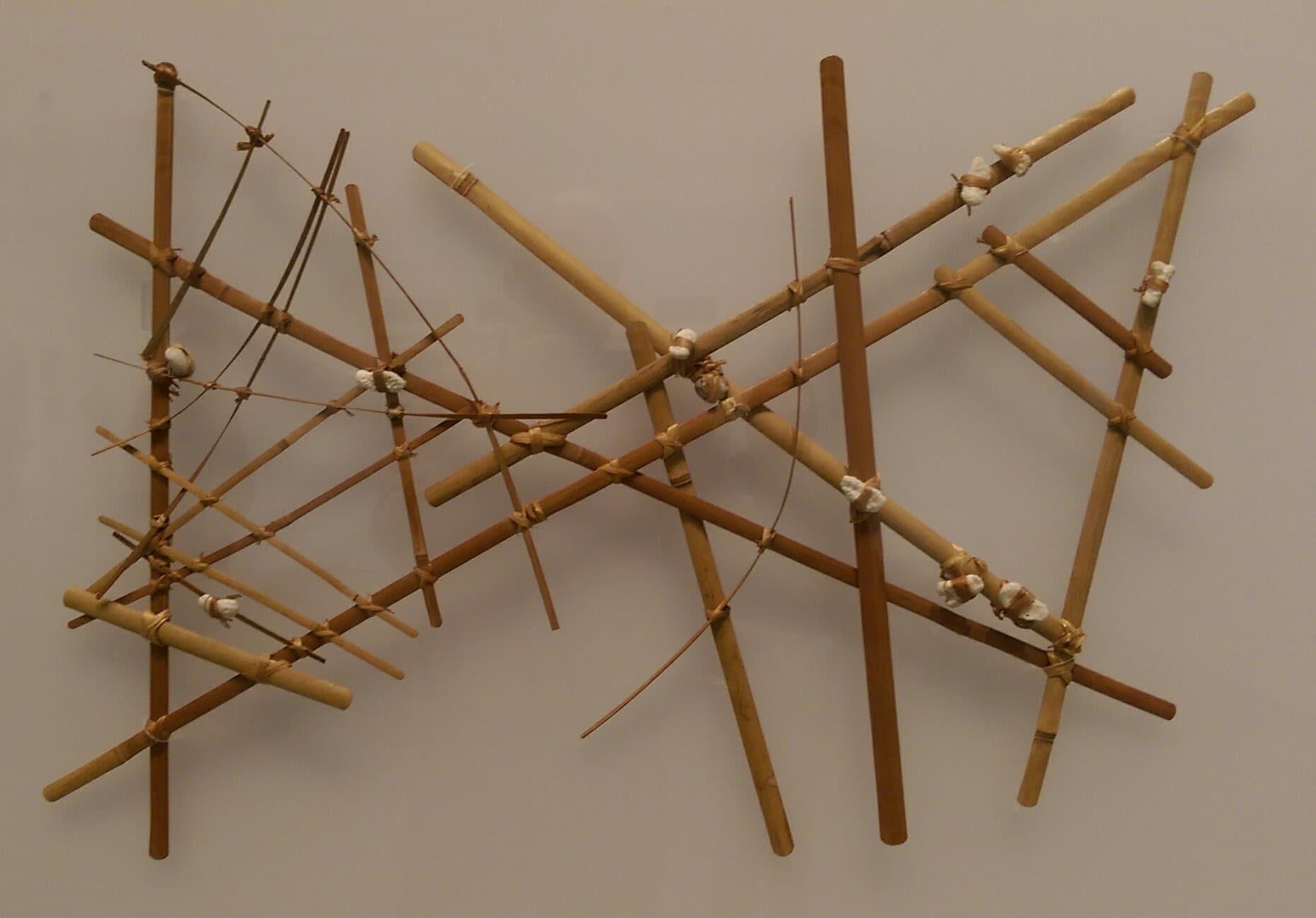
A traditional Marshallese stick chart made from bamboo sticks and small shells tied together

Photo · Wikimedia Commons

O que é isso?

Long before GPS, Marshallese sailors made special maps out of bamboo sticks and shells. These clever maps did not show land - they showed the invisible waves and currents of the ocean. Sailors would memorise them and then leave them at home, reading the waves with their bodies while at sea.

Me conte mais

The Marshall Islands are made up of 29 coral atolls and 5 islands spread across a huge stretch of the Pacific Ocean. To travel between them, ancient navigators needed to find their way across hundreds of kilometres of open water. They solved this challenge by studying how the ocean itself moves.

When ocean swells - long rolling waves - hit an island or atoll, they bend and bounce in a pattern. Skilled navigators learnt to feel these patterns through the hull of their canoe or by lying flat and sensing the rocking. Stick charts were teaching tools: the curved bamboo sticks showed where swells bent around islands, and the shells marked where the islands were.

There are different kinds of stick chart. Some were personal learning maps used only by one navigator. Others were teaching charts shared between families. The knowledge inside them was precious and was passed down through generations as a treasured skill.

Today, stick charts are one of the most famous inventions of the Pacific. They are displayed in museums around the world, and Marshallese artists still make them as a way of celebrating their ancestors' brilliant minds.

Na sala de aula

Conduza sua turma por isso em 15 minutos.

Conversem juntos

Sugestões de discussão

  1. 01If you had to explain directions without a map or phone, what clues would you use?
  2. 02Why do you think navigators memorised the chart rather than taking it on the boat?
  3. 03What other skills do you think you would need to sail between islands you cannot see?
  4. 04If you made a map of your classroom using only sticks, what would the sticks show?
Experimente isso

Atividade para a turma

Make a mini stick chart! Tape five or six short pencils or lolly sticks onto a sheet of card in gentle curves. Then stick a small round sticker (your 'island') where the curves meet. Label your chart and explain to a partner what the curves represent.