
Leçon en classe · The Equator Monument · 🇸🇹 São Tomé and Príncipe

The Equator Monument

Stand on the invisible line that divides Earth in half

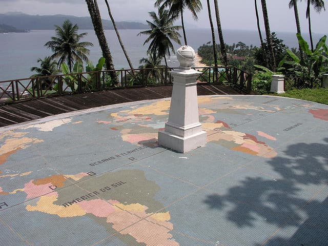
The white Equator Monument marker on São Tomé island with the ocean in the background

Photo · Wikimedia Commons

Qu'est-ce que c'est ?

São Tomé island has a monument marking the exact spot where the equator - the invisible line that runs around the middle of the Earth - crosses the island. Standing at this monument means you are at the very centre of the world, with equal amounts of Earth stretching north and south in front of you.

En savoir plus

The equator is an imaginary circle that divides our planet into the Northern Hemisphere and the Southern Hemisphere. It is not a real line on the ground - but geographers and map-makers have calculated exactly where it runs. At the monument on São Tomé, you can put one foot in the north and one foot in the south at the same moment.

Countries and places on or very close to the equator get almost exactly 12 hours of daylight every day of the year. That is very different from countries further north or south, where days are long in summer and short in winter. On São Tomé, sunrise and sunset happen at roughly the same time all year round.

The sun is also very strong near the equator because it shines almost directly downward rather than at an angle. This is why equatorial countries like São Tomé and Príncipe are warm all year, with lots of rain that feeds their thick rainforests.

The monument itself is a small white marker beside the road, and it is popular with visitors who want a photograph of themselves with one foot in each hemisphere. Schoolchildren from the island often visit as part of their geography lessons.

En classe

Animez cette leçon avec votre classe en 15 minutes.

Discutez-en ensemble

Pistes de discussion

  1. 01If the equator is an imaginary line, how do scientists know exactly where it is? How could they calculate it?
  2. 02Countries near the equator get 12 hours of daylight every day. How is that different from where you live? How might it change daily life?
  3. 03What does it mean to be in the 'Northern Hemisphere'? Which hemisphere do you live in?
  4. 04Why do countries near the equator tend to have thick rainforests? What does the equator provide that forests need?
À essayer

Activité en classe

Draw a large circle to represent Earth. Draw the equator across the middle. Mark the Northern Hemisphere and Southern Hemisphere. Now find and mark São Tomé and Príncipe, your own country, and two other countries - one in each hemisphere. How far is each from the equator?

En savoir plus sur São Tomé and Príncipe

D'autres choses qui rendent São Tomé and Príncipe spécial

Envie que votre classe rencontre São Tomé and Príncipe ?

Choisissez São Tomé and Príncipe lors de votre inscription et nous vous indiquerons la faisabilité en matière de fuseau horaire.

Register your classroom